THE PROPERTY
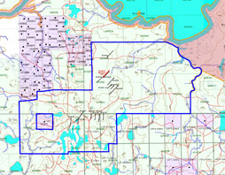 The Eastford Lake property is located at the intersection of Kerrs, Warden, Milligan Townships and the Rayner Lake area in the Timmins Porcupine Mining Camp. The property is accessed via a 16 km, all weather gravel road from Hwy 101 to the south of the property. Explor Resources owns 177 mineral claims covering approximately 3,100 hectares of land.
HISTORY AND GEOLOGICAL BACKGROUND
Previous exploration work surrounding Galleon Gold’s land holdings has been carried out by Kennco Exploration in the mid-1960’s Denison Mines in the mid-1970’s, Bay Resources in 1984, and Wahlex Ltd. in 1997.
In the mid 1960’s, Kennco Exploration reported finding 11 boulders of gold-bearing quartz float just southeast of Eastford Lake. An old photograph shows that one of the boulders was at least 2 metres in width. The average assay of the 11 boulders was 0.328 ounces per ton gold. Kennco believed that the gold-bearing float was part of the Munro Esker and had a bedrock source to the north. Despite geochem sampling, I.P., Mag and diamond drilling they failed to find the bedrock source.
Following a study by the G.S.C. in 1965 and further mapping by Denison Mines in 1976-77, Denison concluded that the gold-bearing float was not part of the Munro Esker, but was rather contained in glacial deposits left by a later glacial advance from the north to northwest. EM and Mag surveying was conducted and concluded that a likely bedrock source for the gold was an apparent till-covered bedrock about 2.5 km northwest of the gold-bearing boulder train. Diamond drilling, however, failed to reveal significant gold in the bedrock.
During Kennco’s exploration efforts in 1965, mercury sampling of soil was conducted in the area of their gold-in-till sampling program. The mercury analyses showed a linear Hg anomaly just at the north end of Eastford Lake, extending for about 1 km in an east-northeast direction.
A later gold soil sampling program by Bay Resources in 1984 confirmed Kennco’s gold anomaly. However, Bay Resources’ much more detailed survey showed that the gold anomaly consisted of a number of discrete elongated anomalies oriented in the direction of the later glacial advance. Furthermore, the northern-most, or up-ice cut-off, of most of the anomalies coincided with the location of Kennco’s mercury anomaly. This suggested that more than one bedrock source of gold was associated with a north-northeast striking fault which was indicated by the mercury anomaly.
During the fall and winter of 2005, Explor Resources (now Galleon Gold) carried out Mag and VLF-EM surveying in the Eastford Lake area. The VLF showed an east-northeast trending EM conductor roughly coincident with the mercury anomaly and the northernmost cut-off of the gold-in-soil anomalies, providing additional confirmation of an important regional fault zone. The Mag showed a strong Mag low immediately adjacent to the VLF anomaly at the north tip of Eastford Lake. The Mag low may indicate a large area of carbonate alteration, or a non-magnetic intrusive body such as a quartz-feldspar porphyry. The Mag also showed repeated linear Mag highs entering the property from the north-northwest and being truncated by the VLF anomaly. These linear Mag highs appear to represent southern extensions of ultramafic rocks.
In April 2006, Explor Resources (now Galleon Gold) drilled a 1,149 m diamond drill hole to test the interpretation of the mafic/ultramafic volcanics environment and to intersect the interpreted regional shear zone. Drill hole EG-06-01 confirmed the interpretations by cutting mafic and ultramafic volcanics as well as multiple intrusions of feldspar and quartz-feldspar porphyry, all rocks typical of gold camps. The hole also confirmed the location of two pyritic shear zones, 1.9 and 1.3 m wide. Strongly anomalous gold values of 210 to 260 ppb were recovered over the widths of the two shear zones.