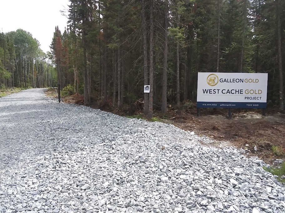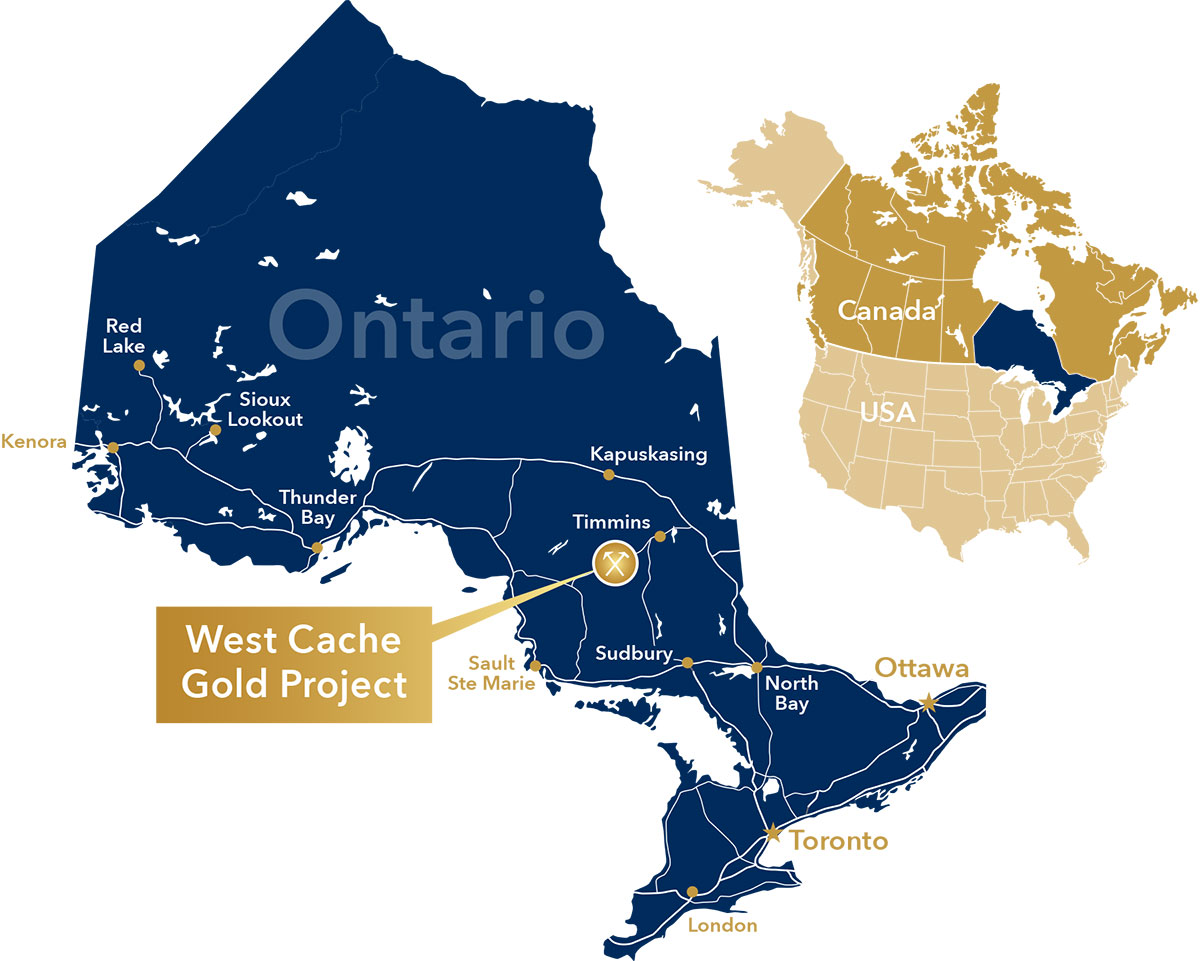
Location
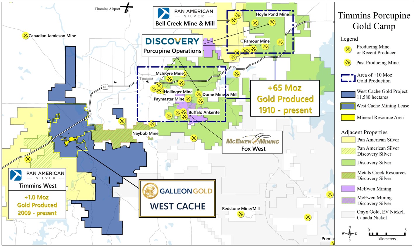
The West Cache Gold Project is located in Bristol, Price and Ogden Townships in the Porcupine Mining Division, District of Cochrane, Province of Ontario. The land package totals 11,570 hectares and is comprised of a mining lease, mining licences of occupation (MLO), patent claims and mining claims. The mining lease hosts the current mineral resource estimate near the center. The Project is 100% owned by Galleon Gold. The property is bisected by highway 101 and can be accessed from the city of Timmins located 13 km to the east. The property is approximately 7 km northeast of Pan American Silver’s Timmins West Mine and 14 km southwest of Discovery’ Silver’s Hollinger Mine.
2022 West Cache 43-101 PEA Technical Report (Effective date: January 10, 2022)
History and Geological Background
The property has been explored since 1927 by numerous ground geophysical surveys and diamond drilling, Dome Exploration discovered and delineated a gold mineralized zone that is approximately 350 meters long and 45 meters wide. Drill programs by Teck Corporation, Cameco Gold and Tom Exploration Inc., extended the mineralization to 350 meters of depth. Explor Resources (now Galleon Gold) intersected gold mineralization in 121 out of 126 holes drilled and in 64 out of 65 wedges. Galleon Gold acquired Explor Resources in December 2019.
Geology and Mineralization
- Mineralization is characterized by pyrite-sphalerite-chalcopyrite stringers to semi-massive sulphide veins hosted by altered and sheared Quartz-Feldspar Porphyry (QFP) and metasediments of the Porcupine assemblage
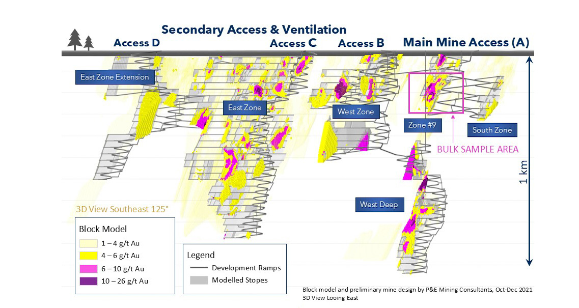
- Drilling indicates that the mineralized shear zones in the QFP extend for 1,975 m along strike and to depths over 1 km
- Gold occurs in several parallel 60° to 80° north dipping veins within a 750 m wide zone that strikes E-W to ENE-WSW
- Over 570 core holes drilled for approximately 210,000 meters of core
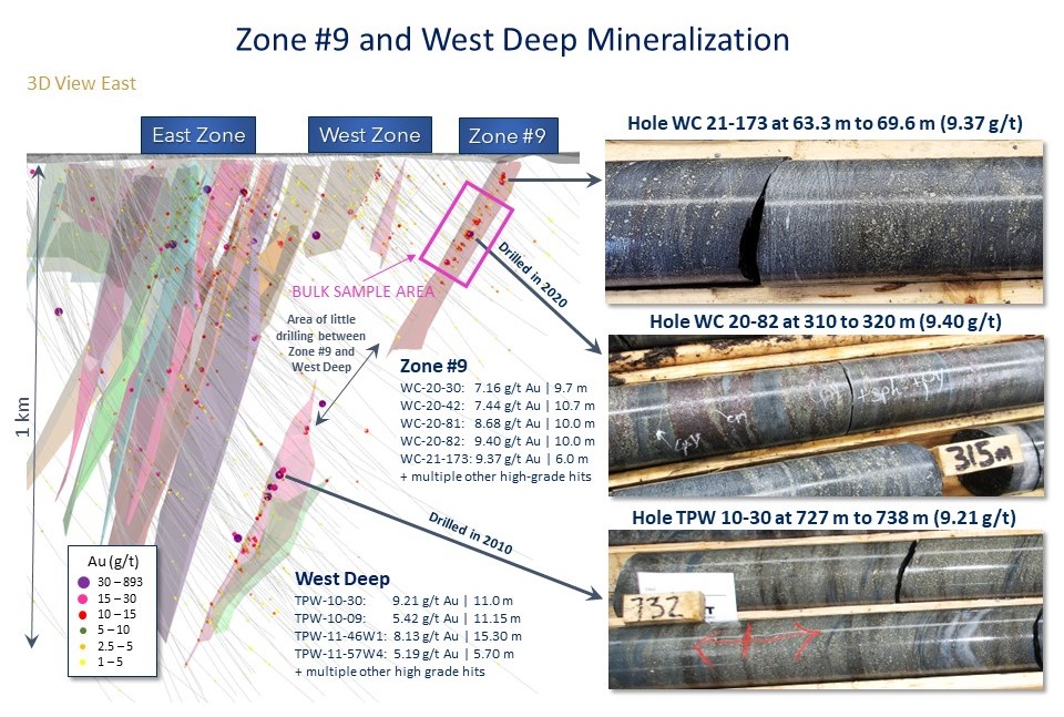
- Mineralized intercepts range from 1-20 m with an average width of 3.5 m with higher-grade intercepts over wider intervals in Zone #9 and West Deep
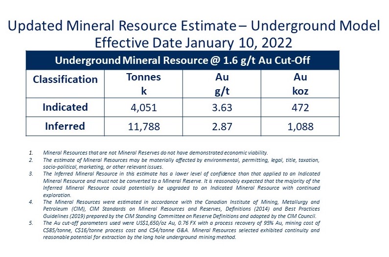
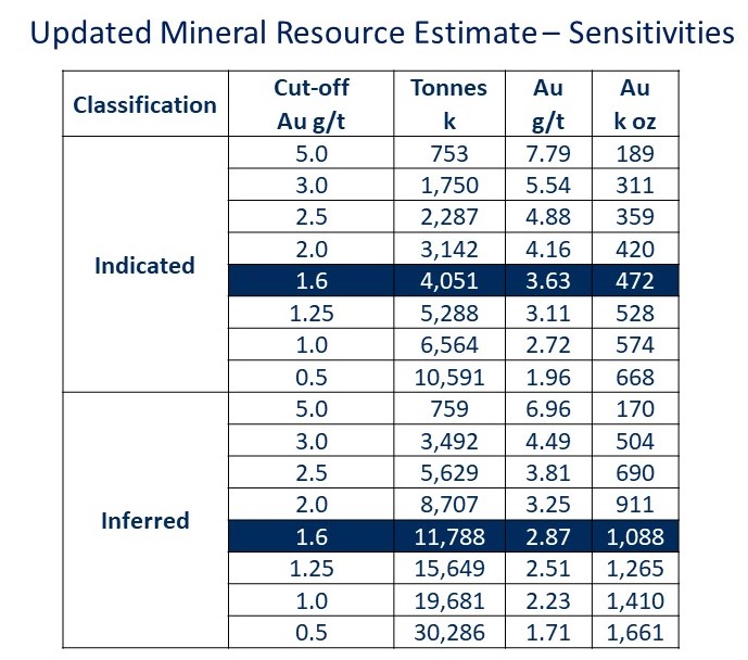
Mineral Resource
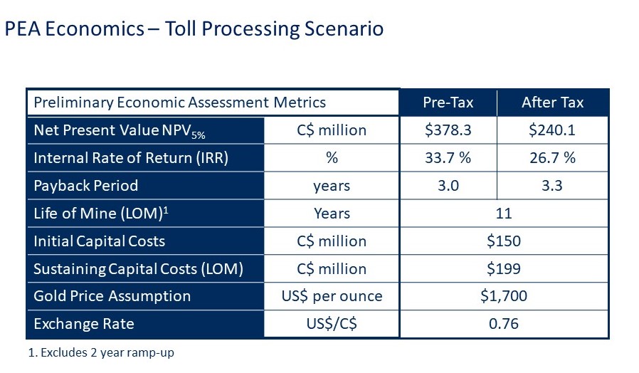
Preliminary Economic Assessment
Plan Development - 3D Looking East
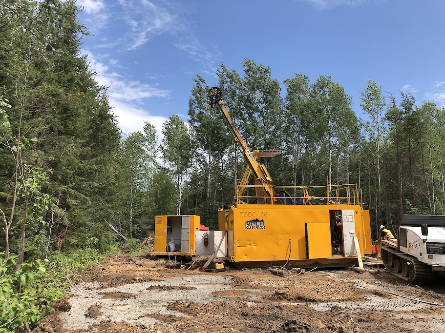
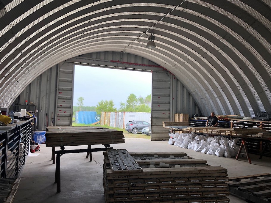
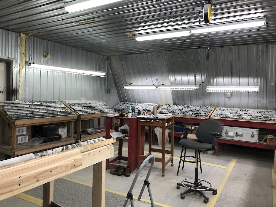
Project Photos